Lantau Peak, Hong Kong’s second highest mountain after Tai Mo Shan, is a gentle giant worth tackling even if you’re not an avid hiker. The 934-metre peak also known as Fung Wong Shan (Phoenix Mountain) looks daunting but the climb is doable for anyone with a little willpower and patience.

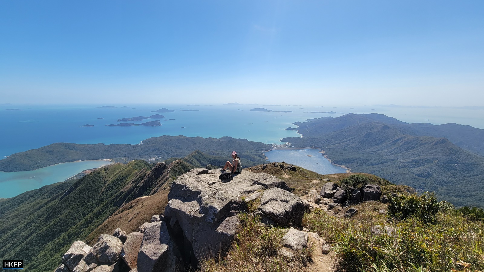
The peak offers vistas of rolling mountains with the ocean all around and a great view of the airport. It’s as far away from the city as you can feel with a 40-minute MTR ride.
It’s also worth noting that Lantau Peak looks completely different depending on the season. During the summer it’s lush and green, with the top often hidden in low clouds and a gentle breeze rolling across the back of the mountain.
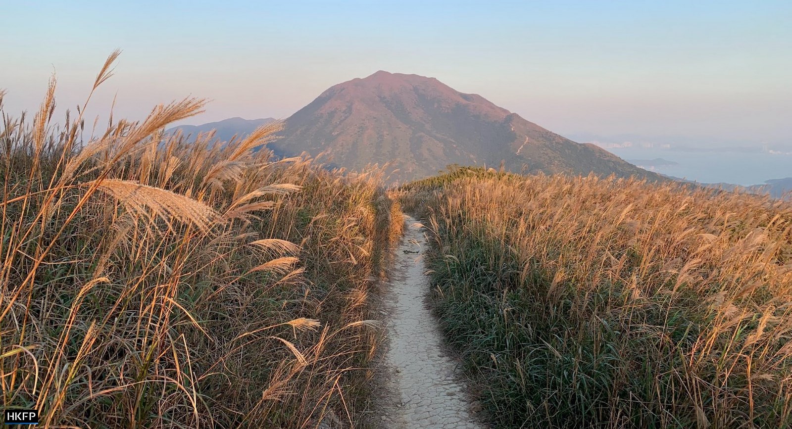
During the winter it turns an autumnal orange-brown, covered in tall grass which attracts photographers. it’s definitely worth doing the climb in both seasons to see it in all its glory.
The total distance is around six kilometres depending on the route you follow down, and it takes most people three to four hours to complete. While it’s often classified as a difficult hike, it’s not dangerous or overly steep. If you are a beginner simply pick a day with cooler weather and leave more time. The hike doesn’t start at sea level, giving you a head start. The total ascent is about 600 meters from Pak Kung Au bus stop.
There are several ways up Lantau Peak. The easiest one is Lantau Trail Section 3, which starts from Pak Kung Au and ends by the Big Buddha in Ngong Ping. It’s also possible to ascend from the other side of the mountain up West Dog Tooth or Middle Dog Tooth, also known as the Dog Teeth Range or Kau Nga Ling. Known for sharp, rocky ridges that are much like fangs, the Dog Teeth routes are challenging and not for the faint of heart.
Pak Kung Au or Tung Chung Gap is easy to reach by public transport. Either take bus 3M to Tung Chung from Mui Wo ferry pier, or bus 3M or 11 from Tung Chung Bus Terminus. If you’re coming from Tung Chung, at Pak Kung Au you will see Sunset Peak to your left and Lantau Peak to the right.
Both are a part of the 70-kilometre Lantau Trail that traverses the whole island and it’s possible to do them both in one day, though we suggest you start with one at first.
Pak Kung Au bus stop has vending machines, public toilets and a BBQ area, which you way want to make use of since there’ll be no more such amenities for the rest of the hike.

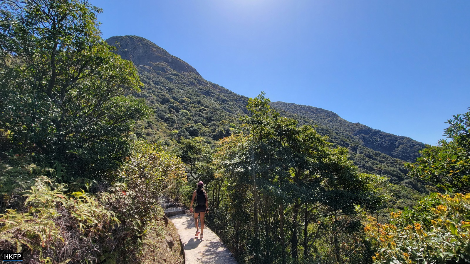
The start of the trail itself is well marked: simply follow the signs up to Lantau Peak. A few minutes into the climb you’ll reach a viewpoint that commemorates the crew of a helicopter which crashed at this location during a rescue mission in 2003.
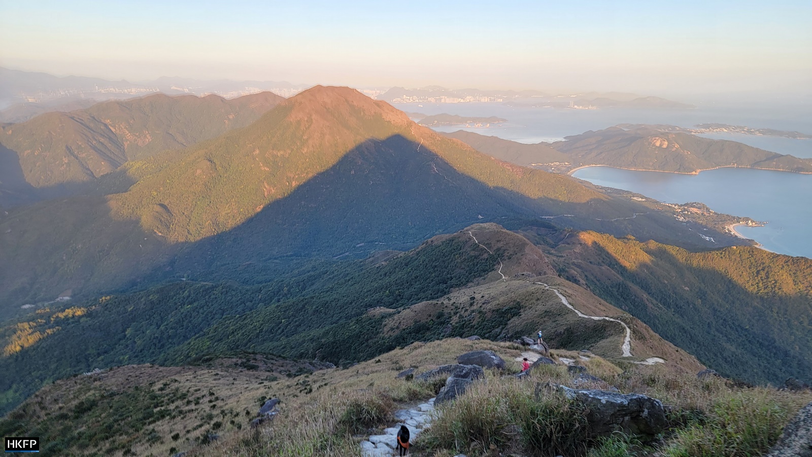
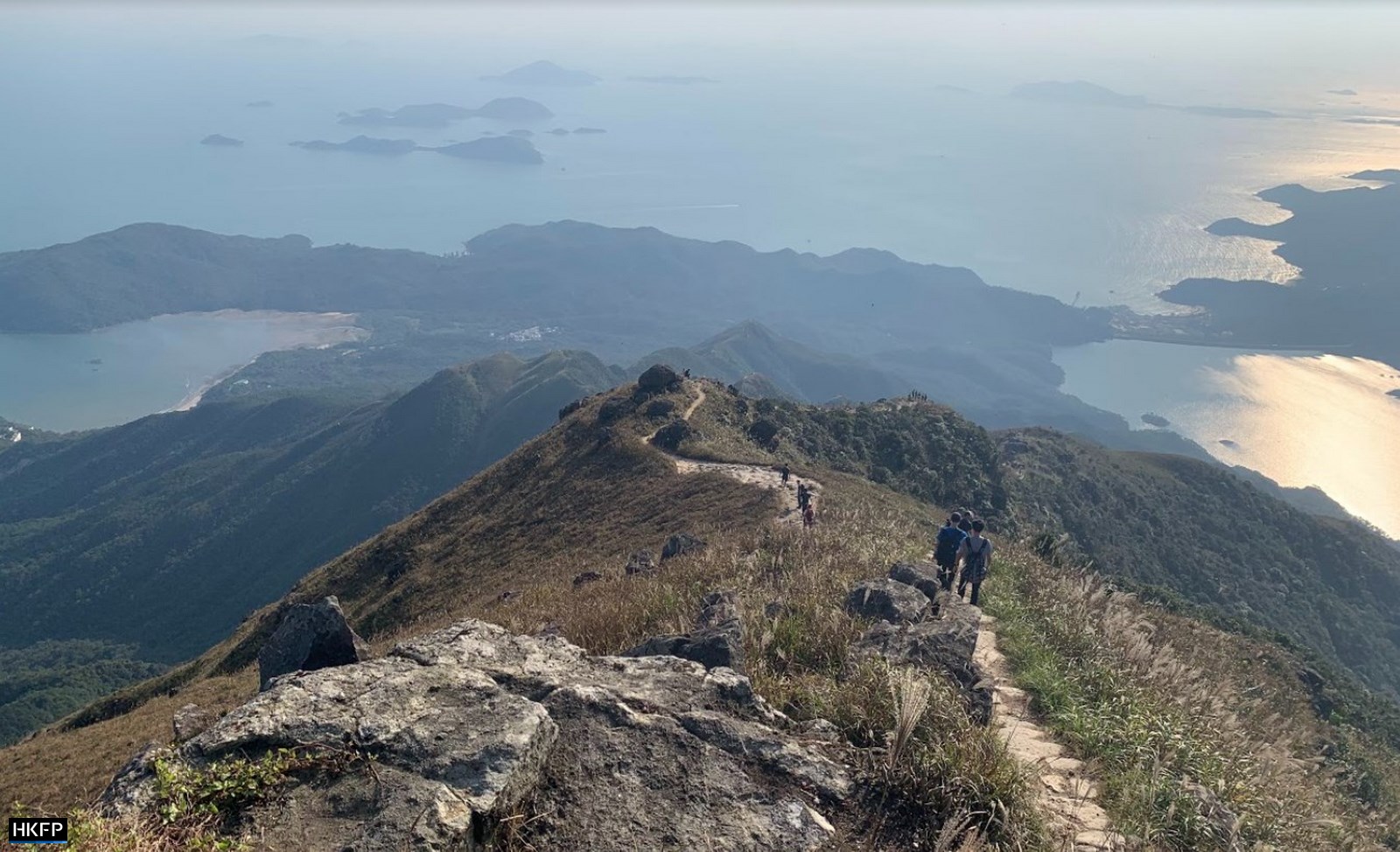
The ascent consists of three levels, or three sets of stairs followed by a flatter part, each bringing you closer to the top. The view gets better and better as you climb, giving you plenty of excuses to stop for photos and catch your breath.
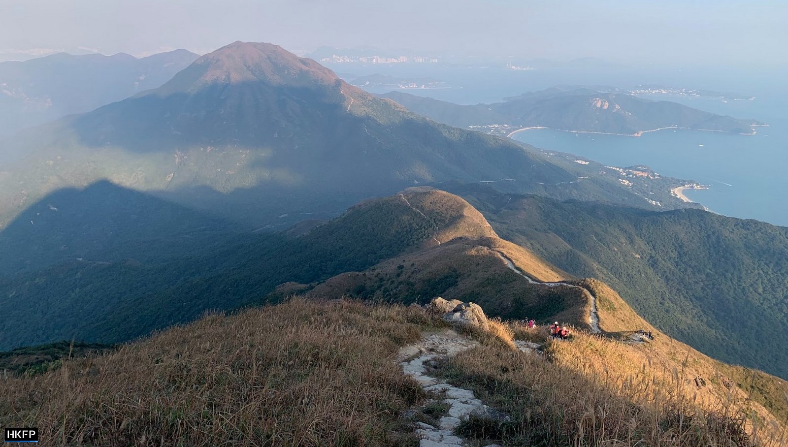
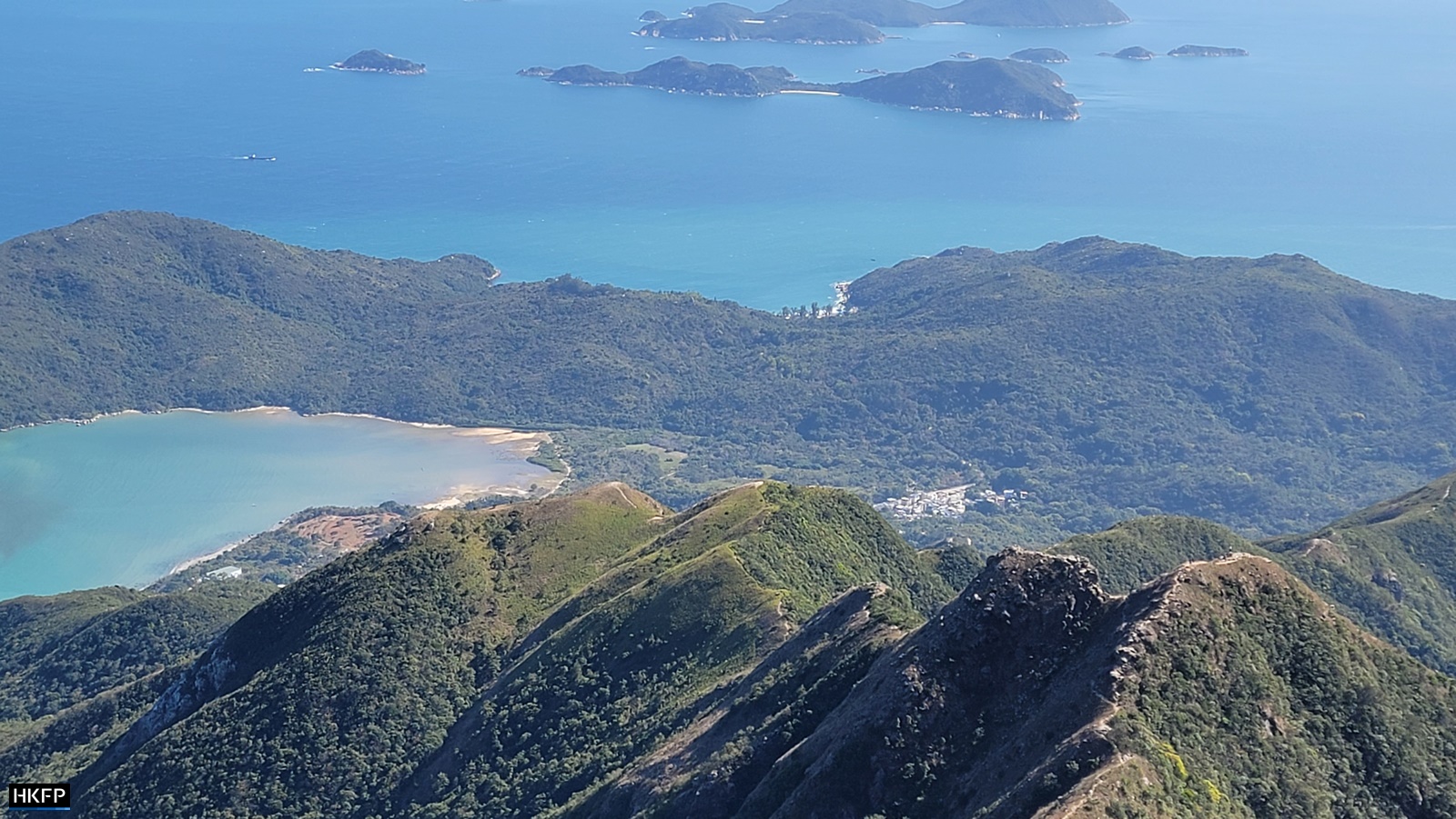
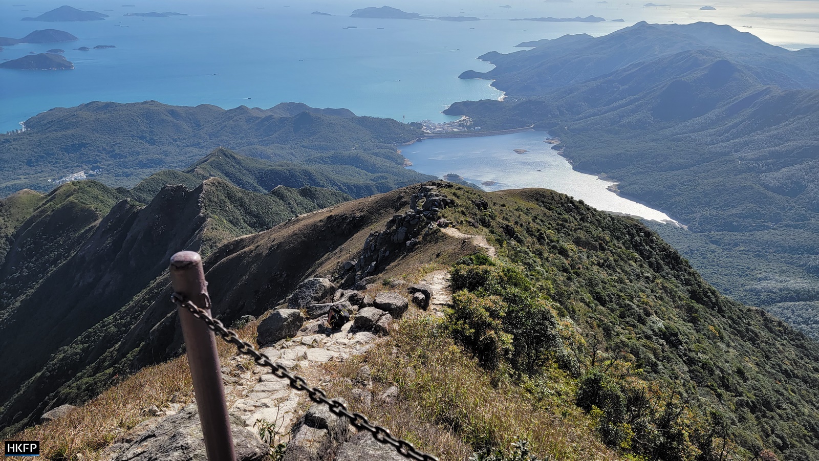
Already from the top of the first hill there’ll be great views of the airport and Sunset Peak behind you. From the base of the third and final hill you’ll see the sharp ridges of the Dog Teeth Range with paragliders and hawks circling above. As you prepare for the final ascent take comfort in the fact that you’re not scrambling up the rocks of West Dog Tooth, but walking up a decent, albeit steep, set of steps.
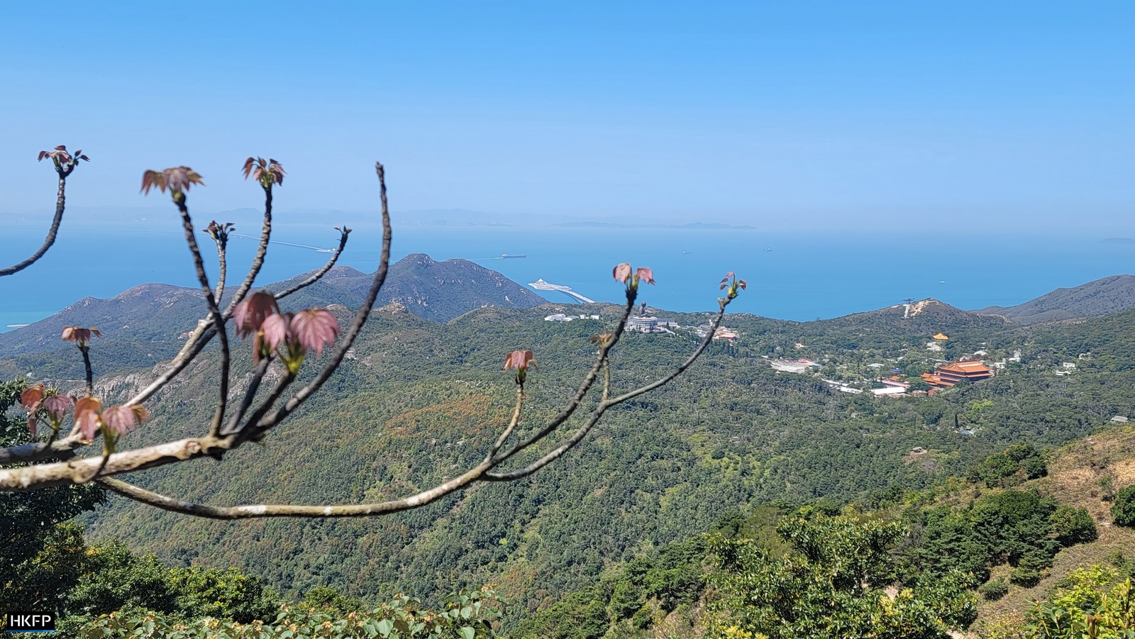
Once you reach the top, take photos with the Lantau Peak sign and make sure to also peek over the other side of the mountain to see the Dog Teeth and Shek Pik Reservoir. Depending on the day, the peak might actually be above the clouds.
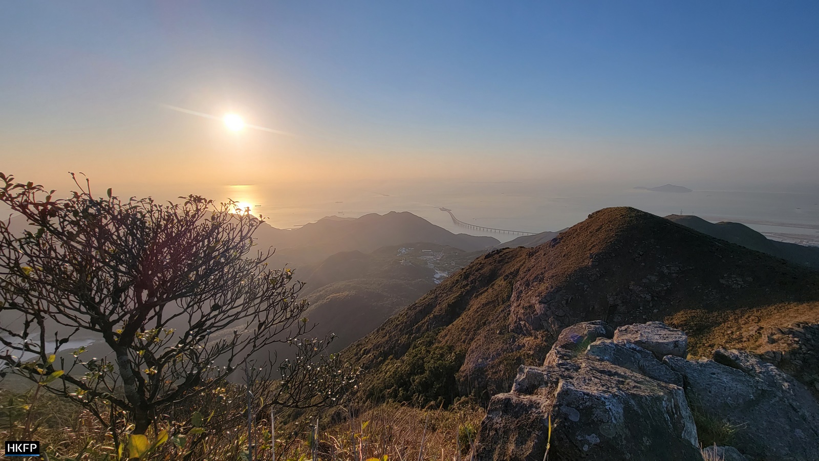
The weather on top of Lantau Peak can be fickle and change at short notice, especially during the summer, so there’s a shelter for emergencies. At almost one kilometre above sea level it’s often cooler so it may be a good idea to bring a sweater or a thermos with tea.
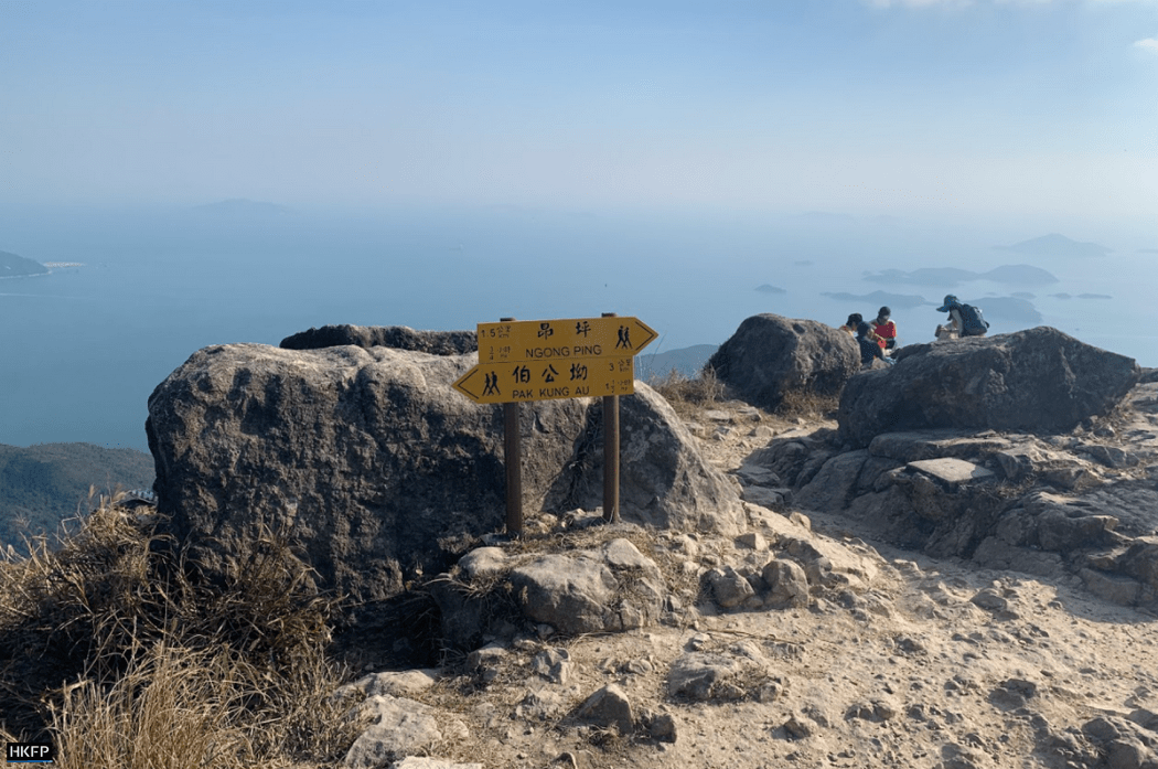
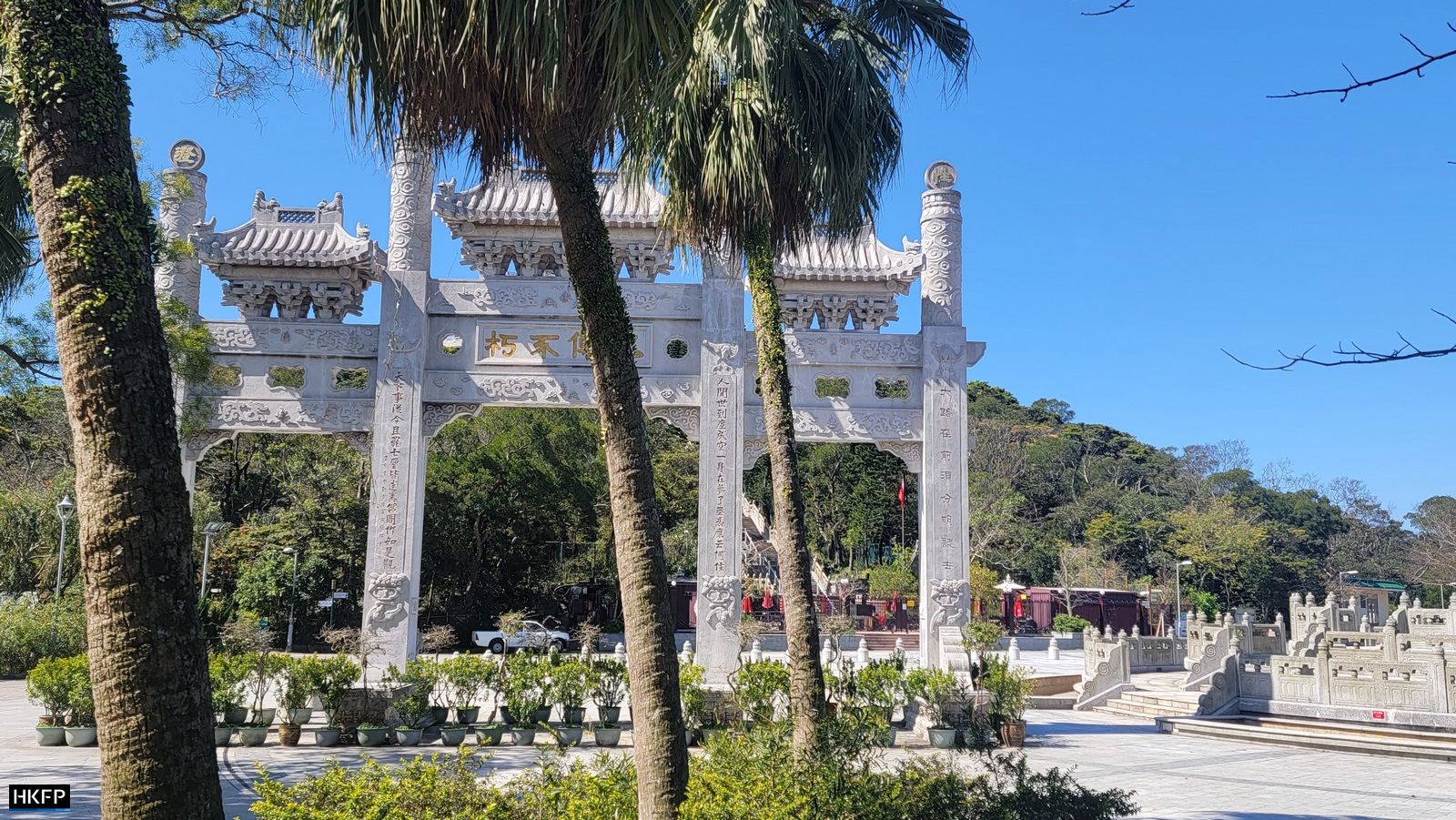
There are two options for the way down. Either follow the same route you came up or cross over to the other side of the mountain and follow the signs to Ngong Ping.

Both take about the same time but offer different views.
Support HKFP | Policies & Ethics | Error/typo? | Contact Us | Newsletter | Transparency & Annual Report | Apps


Help safeguard press freedom & keep HKFP free for all readers by supporting our team

LATEST FROM HKFP


HKFP has an impartial stance, transparent funding, and balanced coverage guided by an Ethics Code and Corrections Policy.

Support press freedom & help us surpass 1,000 monthly Patrons: 100% independent, governed by an ethics code & not-for-profit.